
NASA does not endorse any non-U.S. Government entity and is not responsible for information contained on non-U.S. Government websites.
The Challenge
Websites like the NASA Earth Observatory showcase the many uses of satellite data to highlight interesting natural events. International partner instruments on NASA satellites such as Japan’s ASTER instrument and Canada’s MOPITT instrument, both onboard the Terra satellite, are also included as part of the Observatory. This challenge will ask you to devise a tool or technique to guide users to relevant datasets to study specific events.
Background:
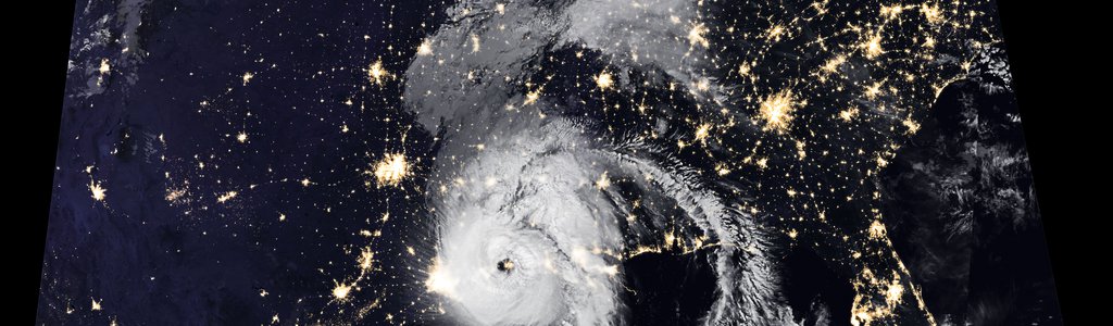
Many researchers (especially early career and citizen scientists) start their journey to Earth science research by studying a particular use case, like a natural disaster (for example, volcanic eruptions, forest fires, earthquakes, floods). For this purpose, collections like the one available through NASA’s Earth Observatory website are superb resources for researchers that are seeking to understand these natural events. The Earth Observatory showcases the many uses of satellite data by publishing images and stories about different Earth science phenomena. The Earth Observatory visualizations are manually created from underlying science data by subject matter experts.
The next step in the research process is to take a deep look into the use case with the scientific datasets related to the phenomenon. For example, in the case of a volcano, the relevant datasets might be aerosols or land surface temperature information. However, finding those datasets can be a time-consuming step for anyone except a trained researcher. Why? NASA's Earth science data archives hold over 6,000 datasets comprising over half a billion files. Those files may themselves be composed of dozens or even hundreds of data variables (or "parameters"). In this scenario, students and citizen scientists who want to look more deeply at such data currently have to search for themselves within NASA's vast archives.
Your challenge is to devise an Earth science dataset recommender to guide users to relevant datasets for studying events such as those represented in the Earth Observatory images and descriptions. How can you minimize the amount of time it takes for researchers to search, collect, and prepare data to study Earth science events in detail?
Potential Considerations:
- Augmenting curated event information with relevant science datasets dramatically reduces the burden on researchers to search for and collect datasets to study an event, thereby enabling them to focus their time on science. In many cases, natural events are tied to disasters and damages, so reducing the time to find relevant datasets has many benefits, including reducing response times during natural disasters.
- Be creative! Examples of hypothetical solutions might include a bookmarklet (a JavaScript code that augments pages such as the event page in Earth Observatory), a web browser extension, or a cloud- or web-based microservice.
- Currently, there are not any dataset recommendation services for Earth observations datasets. Searching data is driven by keyword matching, with additional time and space constraints. How might one use machine learning or natural language processing (NLP) to help researchers search through an Earth science data catalog like NASA’s? NLP could identify the spatial and temporal range from the text and caption of a story in a site such as the Earth Observatory and link it to a catalog like NASA’s Earthdata Search.
- What are your specific needs and wants for your solution? Consider things you don't want as well.
- Your solution might consider the description, location, date, tags, etc. of the events in a site such as the Earth Observatory, along with the metadata that is available (such as in NASA's Common Metadata Repository) to create a relevancy-ranked recommendation service. Could you utilize that service to create a web application in a form like a bookmarklet? How might you display your tool to link from the original webpage the researcher is starting from?
- What features, or “add-ons,” would make a solution stand out?
- For extra precision, you may consider using image matching to target the most likely dataset and variable (parameter) inside a file.
- Recommended resources for particular phenomena (dust, floods) can be found in the Resources tab above. However, search for the following keywords to find additional data: SNPP VIIRS, Landsat OLI, MODIS, MODIS Aqua, and TRMM rainfall.